


Hampton City PUMA, Virginia
About
Outline

Summary
| Unique Area Identifier | 194276 |
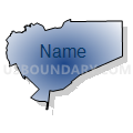
| Name | Hampton City PUMA |
| State | Virginia |
| Area (square miles) | 136.30 |
| Land Area (square miles) | 51.41 |
| Water Area (square miles) | 84.89 |
| % of Land Area | 37.72 |
| % of Water Area | 62.28 |
| Latitude of the Internal Point | 37.04803030 |
| Longtitude of the Internal Point | -76.29714860 |
Maps


Graphs
Select a template below for downloading or customizing gragh for Hampton City PUMA, Virginia


Neighbors
Neighoring Public Use Microdata Area (by Name) Neighboring Public Use Microdata Area on the Map
- James City, York Counties, Williamsburg & Poquoson Cities PUMA, VA
- Middle Peninsula, Northern Neck & Accomack-Northampton Planning District Commissions PUMA, VA
- Newport News City PUMA, VA
- Norfolk City (Northeast) PUMA, VA
- Portsmouth & Norfolk (Southwest) Cities PUMA, VA
- Virginia Beach City (North) PUMA, VA
Top 10 Neighboring County (by Population) Neighboring County on the Map
- Virginia Beach city, VA (437,994)
- Norfolk city, VA (242,803)
- Newport News city, VA (180,719)
- Hampton city, VA (137,436)
- Portsmouth city, VA (95,535)
- York County, VA (65,464)
- Northampton County, VA (12,389)
- Poquoson city, VA (12,150)
Top 10 Neighboring County Subdivision (by Population) Neighboring County Subdivision on the Map
- Virginia Beach city, Virginia Beach city, VA (437,994)
- Norfolk city, Norfolk city, VA (242,803)
- Newport News city, Newport News city, VA (180,719)
- Hampton city, Hampton city, VA (137,436)
- Portsmouth city, Portsmouth city, VA (95,535)
- District 5, York County, VA (12,987)
- Poquoson city, Poquoson city, VA (12,150)
- District 2, York County, VA (12,093)
- District 1, Northampton County, VA (2,231)
Top 10 Neighboring Place (by Population) Neighboring Place on the Map
- Virginia Beach city, VA (437,994)
- Norfolk city, VA (242,803)
- Newport News city, VA (180,719)
- Hampton city, VA (137,436)
- Portsmouth city, VA (95,535)
- Poquoson city, VA (12,150)
- Bethel Manor CDP, VA (3,792)
Top 10 Neighboring Unified School District (by Population) Neighboring Unified School District on the Map
- Virginia Beach City Public Schools, VA (437,994)
- Norfolk City Public Schools, VA (242,803)
- Newport News City Public Schools, VA (180,719)
- Hampton City Public Schools, VA (137,436)
- Portsmouth City Public Schools, VA (95,535)
- York County Public Schools, VA (65,464)
- Northampton County Public Schools, VA (12,389)
- Poquoson City Public Schools, VA (12,150)
Top 10 Neighboring State Legislative District Lower Chamber (by Population) Neighboring State Legislative District Lower Chamber on the Map
- State House District 96, VA (90,800)
- State House District 93, VA (73,204)
- State House District 83, VA (73,171)
- State House District 79, VA (73,068)
- State House District 94, VA (71,464)
- State House District 92, VA (71,017)
- State House District 95, VA (67,882)
- State House District 91, VA (64,074)
- State House District 100, VA (52,095)
Top 10 Neighboring State Legislative District Upper Chamber (by Population) Neighboring State Legislative District Upper Chamber on the Map
- State Senate District 2, VA (177,071)
- State Senate District 1, VA (170,275)
- State Senate District 6, VA (152,346)
Top 10 Neighboring 111th Congressional District (by Population) Neighboring 111th Congressional District on the Map
- Congressional District 1, VA (786,237)
- Congressional District 3, VA (663,390)
- Congressional District 2, VA (646,184)
Top 10 Neighboring Census Tract (by Population) Neighboring Census Tract on the Map
- Census Tract 103.04, Hampton city, VA (7,638)
- Census Tract 101.03, Hampton city, VA (7,108)
- Census Tract 103.13, Hampton city, VA (6,673)
- Census Tract 502.03, York County, VA (6,652)
- Census Tract 104, Hampton city, VA (6,628)
- Census Tract 502.06, York County, VA (6,582)
- Census Tract 101.04, Hampton city, VA (6,536)
- Census Tract 103.06, Hampton city, VA (6,355)
- Census Tract 314, Newport News city, VA (6,276)
- Census Tract 303, Newport News city, VA (6,217)
Top 10 Neighboring 5-Digit ZIP Code Tabulation Area (by Population) Neighboring 5-Digit ZIP Code Tabulation Area on the Map
- 23666, VA (49,825)
- 23669, VA (43,148)
- 23503, VA (30,856)
- 23703, VA (25,739)
- 23601, VA (25,127)
- 23607, VA (24,519)
- 23693, VA (23,292)
- 23663, VA (14,495)
- 23661, VA (14,113)
- 23605, VA (13,854)